Contents
- 🎵 Origins & History
- ⚙️ How It Works
- 📊 Key Facts & Numbers
- 👥 Key People & Organizations
- 🌍 Cultural Impact & Influence
- ⚡ Current State & Latest Developments
- 🤔 Controversies & Debates
- 🔮 Future Outlook & Predictions
- 💡 Practical Applications
- 📚 Related Topics & Deeper Reading
- Frequently Asked Questions
- References
- Related Topics
Overview
The genesis of aerial photography traces back to the mid-19th century, a period brimming with innovation in both photography and flight. Gaspard-Félix Tournachon, known as Nadar, is widely credited with taking the first successful aerial photographs from a hot-air balloon over Paris in 1858, though these images are now lost. The earliest surviving aerial photographs were captured by James Wallace Black in 1860, also from a balloon, depicting Boston from an altitude of approximately 1,200 feet. These pioneering efforts were fraught with technical challenges, requiring bulky equipment and precise meteorological conditions. The advent of lighter, more portable cameras and improved ballooning techniques in the late 19th and early 20th centuries allowed for more widespread application, notably in military mapping during conflicts like the Boer War and World War I, where aerial reconnaissance became a critical strategic asset.
⚙️ How It Works
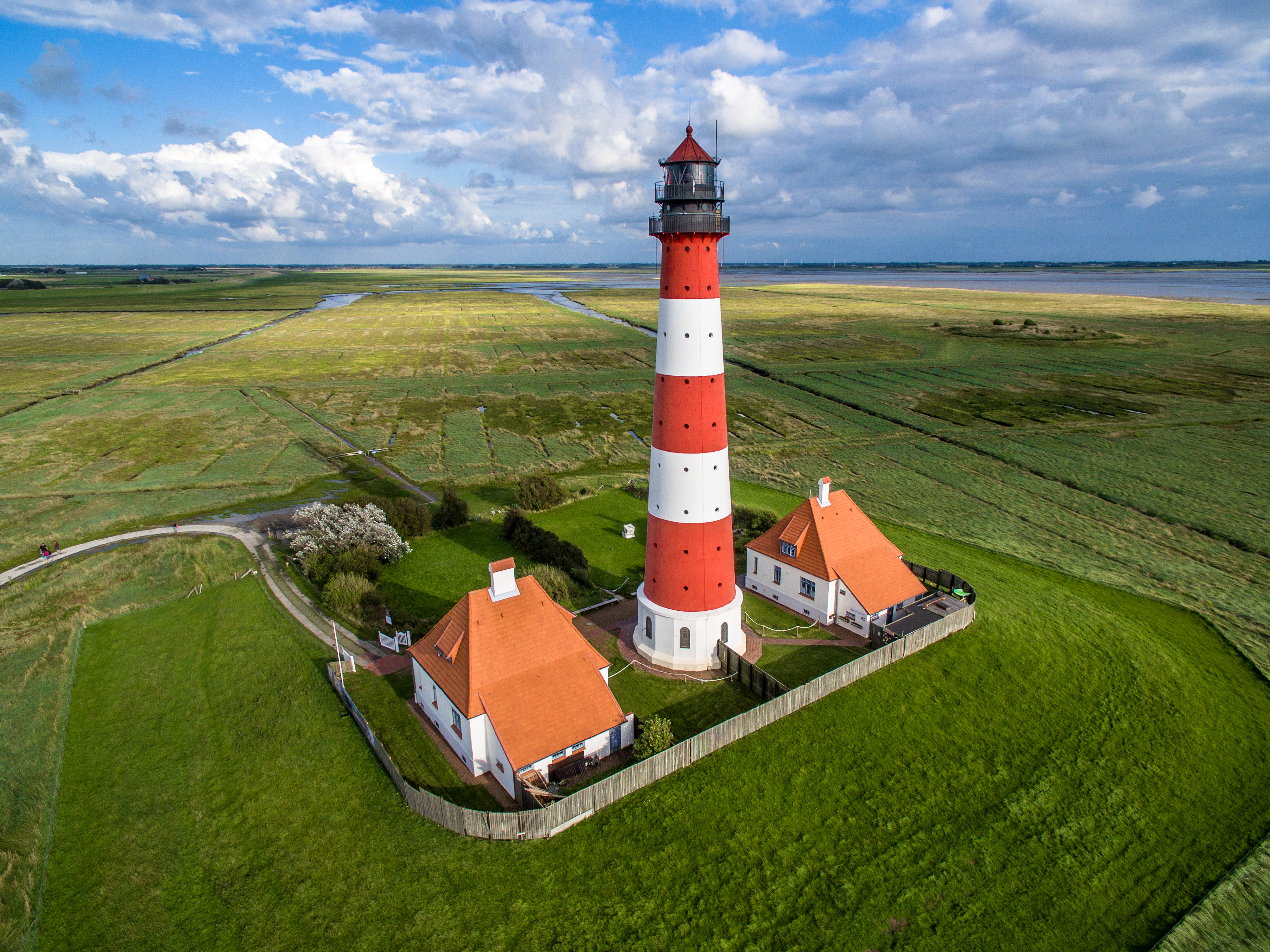
At its core, aerial photography involves mounting cameras onto a stable platform that can achieve sufficient altitude and maneuverability. Historically, this meant balloons or early aircraft, often equipped with large-format plate cameras. Today, the process is far more diverse. Fixed-wing aircraft and helicopters are still employed for large-scale surveys and high-resolution mapping, fitted with specialized digital cameras or LiDAR scanners. However, the most significant recent development is the widespread adoption of UAVs, commonly known as drones. These platforms can carry high-resolution digital cameras, multispectral sensors, or even thermal imaging equipment, allowing for precise, low-altitude capture controlled remotely via ground stations or autonomous flight paths. Image stabilization technology and advanced GPS positioning are crucial for ensuring sharp, georeferenced imagery, regardless of the platform's movement.
📊 Key Facts & Numbers
The scale of aerial photography is staggering. It's estimated that over 10 million aerial images were captured during World War I alone, fundamentally changing military intelligence. By the 1980s, the U.S. Geological Survey (USGS) had mapped over 90% of the United States with aerial photography. Today, the global drone market, a significant driver of aerial imagery, was valued at approximately $28.1 billion in 2021 and is projected to reach $40.7 billion by 2026, according to Goldman Sachs reports. Companies like Google Earth have digitized vast portions of the planet, with their imagery database containing petabytes of data, updated regularly. The resolution of commercially available drone cameras can now exceed 100 megapixels, capturing details as small as a few millimeters from a few hundred feet.
👥 Key People & Organizations
While Nadar and Black were pioneers, many individuals and organizations have shaped aerial photography. George R. Lawrence's 1914 panoramic photograph of San Francisco, taken from a custom-built camera suspended from 13 kites, showcased early ingenuity. During World War II, the Royal Air Force and the United States Army Air Forces established extensive aerial reconnaissance units, employing photographers like Tony Vaccaro. In the digital age, companies like Pix4D and DroneDeploy have become leaders in developing software for processing and analyzing aerial imagery captured by drones. The National Geographic Society has consistently utilized aerial photography to document the world's landscapes and cultures, influencing public perception and scientific understanding.
🌍 Cultural Impact & Influence
Aerial photography has profoundly reshaped our visual culture and understanding of the world. It provided the first true bird's-eye views, moving humanity beyond ground-level perspectives and fostering a sense of global interconnectedness. Its use in urban planning and infrastructure development, exemplified by projects like the Tennessee Valley Authority's early mapping efforts, has allowed for more efficient resource management and city design. In archaeology, aerial photography has revealed hidden structures and patterns invisible from the ground, such as the Nazca Lines in Peru or ancient Roman field systems. Filmmakers have leveraged aerial shots to create epic vistas and dynamic action sequences, from classic Hollywood epics to modern blockbusters like Top Gun: Maverick. The ubiquity of drone footage on platforms like YouTube has also democratized this perspective, making it a common element in social media and online content.
⚡ Current State & Latest Developments
The current landscape of aerial photography is dominated by the rapid advancement and accessibility of UAVs. In 2024, drone technology continues to shrink in size and cost while increasing in capability, with AI-powered flight planning and automated data analysis becoming standard. Companies are integrating drone-captured data into Geographic Information Systems (GIS) more seamlessly than ever before. Furthermore, advancements in sensor technology, including hyperspectral and thermal imaging, are expanding the applications beyond visual capture into scientific research and industrial inspection. The regulatory environment for drone operation, particularly in urban areas and for commercial purposes, is also a major area of development, with bodies like the FAA continually updating guidelines.
🤔 Controversies & Debates
The practice of aerial photography is not without its controversies. Privacy concerns are paramount, as drones equipped with high-resolution cameras can easily capture images of private property and individuals without consent, leading to debates about surveillance and data protection. The ethical implications of using aerial imagery for military purposes, including targeted strikes and battlefield surveillance, remain a significant point of contention. Furthermore, the environmental impact of widespread drone usage, from battery disposal to potential wildlife disturbance, is an emerging area of concern. The debate also extends to data ownership and access, particularly when large corporations or government agencies collect vast amounts of aerial data.
🔮 Future Outlook & Predictions
The future of aerial photography points towards even greater integration with artificial intelligence and augmented reality. We can expect AI to automate more complex tasks, such as object recognition, change detection, and predictive analysis from aerial data. The development of swarming drone technology could enable large-scale, synchronized data capture for complex environmental monitoring or disaster response. Furthermore, the integration of aerial imagery with AR and VR technologies will likely create immersive experiences, allowing users to 'walk' through historical sites or explore remote landscapes virtually. The ongoing miniaturization of sensors and platforms suggests that aerial capture will become even more pervasive, potentially integrated into everyday devices.
💡 Practical Applications
Aerial photography serves a multitude of practical purposes across diverse sectors. In agriculture, it enables precision farming through crop health monitoring and yield prediction. Construction companies use it for site surveying, progress tracking, and safety inspections. Environmental scientists rely on it for monitoring deforestation, glacier melt, and coastal erosion. Emergency services utilize aerial imagery for disaster assessment, search and rescue operations, and wildfire management. Real estate developers and marketers employ it to showcase properties and urban developments. Even in the arts, aerial photography is used to create stunning visual works that offer new perspectives on familiar subjects, pushing the boundaries of aesthetic appreciation.
Key Facts
- Year
- 1858
- Origin
- France
- Category
- technology
- Type
- technology
Frequently Asked Questions
What is the difference between aerial photography and satellite imagery?
Aerial photography is captured from platforms within Earth's atmosphere, such as aircraft or drones, typically at lower altitudes and with higher resolution. Satellite imagery, conversely, is captured from spacecraft orbiting far above the Earth, offering broader coverage but often with less detail. While both provide overhead views, aerial photography offers greater flexibility in timing, angle, and resolution for specific, localized areas, whereas satellite imagery excels at global-scale monitoring and long-term trend analysis.
How has drone technology changed aerial photography?
The advent of UAVs has dramatically democratized aerial photography, making it more accessible, affordable, and versatile. Drones allow for low-altitude, high-resolution capture with unprecedented maneuverability, enabling precise mapping, detailed inspections, and dynamic videography that was previously impossible or prohibitively expensive. This has opened up new applications in fields like agriculture, construction, and real estate, and has also led to increased public awareness and concern regarding privacy and surveillance.
What are the main applications of aerial photography today?
Today, aerial photography is indispensable across numerous sectors. It's crucial for GIS and cartography, enabling detailed mapping and land surveying. In agriculture, it supports precision farming by monitoring crop health and optimizing resource allocation. The construction industry uses it for site assessment and progress tracking, while environmental scientists employ it for monitoring climate change impacts, deforestation, and wildlife populations. Furthermore, it's a vital tool for military reconnaissance, urban planning, and filmmaking, providing unique perspectives for analysis and storytelling.
What were the earliest uses of aerial photography?
The earliest uses of aerial photography were primarily for military reconnaissance and mapping, beginning in the mid-19th century with balloon-borne cameras. During conflicts like the American Civil War and later World War I, aerial photographs provided invaluable intelligence on enemy positions and terrain. Beyond military applications, early pioneers also used aerial photography to document urban development and explore inaccessible landscapes, laying the groundwork for its future use in scientific and civil endeavors.
Are there ethical concerns surrounding aerial photography?
Yes, significant ethical concerns exist, primarily revolving around privacy. The ability of drones and aircraft to capture high-resolution imagery from above raises issues of surveillance and the potential for misuse, particularly concerning private property and individuals. Military applications of aerial photography also present ethical dilemmas related to targeting and collateral damage. Debates also touch upon data ownership, the environmental impact of widespread drone deployment, and the potential for aerial imagery to be used for intrusive marketing or monitoring.
How can I get started with aerial photography?
Getting started with aerial photography typically involves acquiring a suitable platform, such as a consumer drone or, for more advanced work, partnering with a professional aerial service. For drone operation, understanding local regulations, such as those set by the FAA in the United States, is crucial. Learning basic photography principles, including composition, lighting, and camera settings, is essential. Many online courses and tutorials are available for both drone piloting and aerial photography techniques, and practicing in open, safe areas is recommended before attempting more complex shoots.
What is the future of aerial photography likely to involve?
The future of aerial photography is expected to be heavily influenced by advancements in AI and AR. AI will likely automate more complex data analysis, object recognition, and predictive modeling from aerial data. Swarming drone technology could enable large-scale, coordinated data capture for environmental monitoring or emergency response. Integration with AR/VR will offer immersive experiences, allowing users to virtually explore captured environments. Continued miniaturization and cost reduction will further increase accessibility and integration into everyday technologies.